Thursday, 19 April 2012

Mount Everest Base Camp Trek

After 5 days of fun in Kathmandu, we packed up our trek bags, said goodbye to luxuries and set the alarm for 5.30am. On went our trek boots for the first time this trip and we headed off to the airport with Kym. The domestic side of Kathmandu airport is even more chaotic than the international side and we were glad to have Kym to navigate the way and get out bags sorted.


We were introduced to Phora our lead guide for the trek, who would be flying with us. An Everest veteran Sherpa with seven Everest Summits to his name, we were quite privileged to have him. We later found this award for him in the Sherpa Museum at Namche.


After a relatively short flight but with wonderful views of the Himalayas we started the descent into Lukla. I struggled not to have to close my eyes as we came in, with the aircraft tilting downward towards the runway that was going upward! We landed safely to a round of applause and were parked outside the airport building literally within seconds (the runway is that short!).


I don’t have time to write up the itinerary of the whole trek and as its now been a while since we came back, I can’t remember a lot of it! But we’re off to Canada soon, and if I don’t write something here now I’ll never get around to it. The full itinerary is here. Highlights were: the first view of Everest, the beautiful Ama Dablam, the lovely Culture Home Lodge at Namche Bazaar, the odd occasion where we got a hot shower, seeing Everest climbers walking alongside us with their most precious personal equipment on their backs (boots, crampons, ice axes etc), the monasteries perched up high upon seemingly inaccessible mountain ledges, the closer views of Everest, Lhotse, Nhupse etc..... and the wonderful hospitality of the people of the Khumbu Valley.


Tea stop!!


Namche Bazaar


Everest!! (from a little distance!)


Ana Dablam


We didn’t quite get to Everest Base Camp. We got to Lobuche the night before the final leg, had supper and everything was fine. However, it was bitterly cold. The water bottles froze in the bedroom and I got crackly breathing, which is not a good sign (can indicate AMS). After some advice from a fellow trekker who happened to be a Doctor (thanks Mike) we went to bed but decided to go down in the morning. We’d got to 5000 metres, good enough for us. Samir, Vivek and Jason went up to Gorek Shep and then on to Base Camp but the top of Kala Pattar was a bridge too far, even for the young men, as it was so cold.We headed down to Pheriche with Rowena and I got my breathing checked at the Altitude Clinic there and we enjoyed the rest for a day. We walked back to Lukla via a slightly different route and braved the wobbly plane again. We had front row seats and the plane just drove off the side of the mountain, literally!!

I took this video of the take off from Lukla from my seat. When you take to the sky from a VERY short runway off the side of a mountain there is little room for error .....and NO chance to abort the takeoff!!


and here's the view just before take off, with a sheer drop at the end!

Kathmandu

We arrived in Kathmandu via Delhi. The weather was warm and sunny and we had great views of the Himalayas on the way in – and all the brick factories with their tall chimneys. Kathmandu airport was an experience but not unpleasant, just a little chaotic, with the visa applications area a bit of a job creation exercise. As we emerged from the airport I saw a red board with a Lion on it being held within a sea of young men greeting arrivals in the hope of getting a tip. We headed for him and tried to avoid our luggage being picked up by more men hoping for more tips. He found Kym our guide and, after a 'Namaste' and a couple of prayer scarves wrapped around us, we were whisked away in a car. Driving the very bumpy and noisy streets to the hotel was useful acclimatisation to the Kathmandu traffic chaos that is the norm in the city. The Shangri Las was a nice hotel in a good location, just a 15 minute walk from the bustle of Thamel, but affording a bit of welcome peace at night.


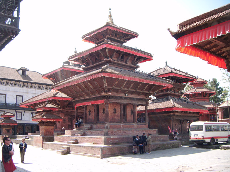
All the other tourists got taxis everywhere but we chose to walk, even in the areas outside of main tourist drag. We looked a little conspicuous but it was good to see how Kathmandu really is for the people who live there. We did all the usual that Thamel has to offer, Durbar Square, all the shops and stalls and the bars and restaurants. We walked to the outlying temples, including the Monkey Temple, high up with its great views of the sprawling city.


We also walked to the temple complex at Pashupatinath where, after touring the temples and grounds, we sat on the hill and watched the funeral pyres burning all along the river.


We found Kathmandu dirty, noisy and smelly. We also saw immense deprivation on our travels walking the city. Yet, the city is full of character, has an enduring charm and the inhabitants are the most wonderfully friendly people, welcoming but discreet and very respectful. We had some great food amongst the restaurants, with our favourite being Dechenling.

We ate in Rum Doodles, the haunt of expedition climbers, with all the 100’s of footprints bearing the signatures of climbers and trekkers including, poignantly, some climbers like Rob Hall who have perished in the Himalayas.  On the night before we left we were introduced to our fellow trekkers, who we wouldn’t see for a couple of days, as we were heading into the mountains early. Rowena and Samir from Bombay, Vivec from Singapore and Jason from Sydney – we would truly be an international party!!

Friday, 9 March 2012

Next stop Kathmandu

Well, I blinked again and another 2 months went by. A couple of breaks with family, a week in London and some local hiking is about all we've done over the last 8 weeks. However, in that time we've packed No 2 son off to a new job in Scotland, packed the old man off to work 4 days a week on a temporary contract and poured over world maps and travel guides wondering where to take the next vacation.


We decided on a 3 week trek at altitude between 2800 and 5300 metres through the Khumbu Valley in Nepal, with a week in Kathmandu first. We like to sail close to the wind - we booked it last Friday and leave Tuesday! The itinerary can be found here if anyone is interested.

After some fun in the capital, we will start the trek off with a hair raising flight into Lukla, with its runway on a 12% gradient. The gradient is to ensure the aircraft landing there stop in time before hitting the mountain, as the runway is only 1500 feet long!!! Ultimately the trek goes to Everest Base Camp at 5300 metres, with an assent of Kala Pattar at 5545 metres before returning to Lukla via a slightly different route. It's a tough trek but we've been out and about here regularly doing some long hikes and I've been putting in some extra training. Ultimately the altitude is likely to determine whether we/I get to EBC, but we'll see all the big mountains: Everest, Lhotse, Nuptse etc. anyway. Can't believe that 4 days after we return I will be back at work though!

Saturday, 14 January 2012

Happy New Year! Where did 2011 go?!

Well, I blinked since last writing here and 4 months went by! We've been out and about in the UK since returning from Europe, including York & Harrogate, where we mixed a long weekend in the autumn sunshine with a bit of business. We took a weekend at the Old Bridge Hotel in Huntingdon, trying out their wine cellar and exploring a bit of Cambridgeshire. Lots of weekends and short breaks in the Cotswolds and a couple in the New Forest, add in Christmas and seasonal business interests in the run up to it and the time just flies by. Sadly, we also had 2 family bereavements during that time.

After a lovely, but quiet Christmas at home with the children, we flew out New Years Eve to enjoy 10 days in Switzerland together with family. After a few days we had rather more snow than we are used to there, but thankfully we got home before the really big snow storm that brought many resorts to a standstill, or cut them off altogether like Zermatt.


We took snow shoes and walked the Arolla valley, which was beautiful, with clear blue skies and fresh powdery snow. We also did a bit of cross country skiing at Evolene, which was fun. Add a visit to a spa, some general rambling locally and playing in the snow with the children and a good time was had by all.


We're now home and busy wading through brochures and websites trying to decide where to go for a last adventure before I return to work on 1/4/2012. I want to have spent at least 6 months of my year off overseas, another 3 weeks and I will have achieved that. We might end up literally sticking a pin in a map whilst blindfolded but I would like to trek the Himalayas, just unsure if the altitude will agree with me after only getting to 5200 metres on Kilimanjaro. We'll see but we have to decide soon, as we want to be away for most of March.

Saturday, 6 August 2011

Torrent Neuf Bisse

We decided to revisit this bisse today. The weather was slightly better than last time, but not by much. The last part was closed due to maintenance, so we'll have to return again to see the whole thing. Nevertheless, it made a nice walk, with better views than last time.


The Thermal Spa at Ovronnaz

We like it here! After a long weekend hiking, the sun shone and we relaxed for the day!

Fiescheralp and the Aletch plateau

We did indeed leave early but at the start of the Swiss National Holiday weekend, perhaps quick progress was a bit optimistic! We sat in blistering heat on the approach to Visp but got through and managed to get to Fiesch before noon. We parked Valerie and made our way up on the gondola to Fiescheralp. We checked into the hotel, dumped our stuff, put our walking boots on and headed up to the Eggishorn, keen not to waste either our time, or our lift passes. The gondola takes you to  2869 metres and you scramble over rocks and boulders along a steep climb to the summit of Eggishorn at just under 3000 metres, where you get a great view of the Aletch glacier, even in cloud.


Top right is the summit of Eggishorn.


On your way up and down you see the brave tackling the difficult climb over the Bettmerhorn with ropes etc. - maybe next time ;)

We walked and walked for 4 days, until we were sore! The weather was lovely and the views spectacular. We did just about the whole area. Only the hangbridge at the leading edge of the glacier eluded us, simply because the location of our hotel meant we simply couldn't make it there and back before dark, as our hotel was at the other end.


This was the glacier the second day in sunshine. I have yet to find out why it looks like a massive JCB has driven down it. The glacier is 900 metres deep (just for a bit of perspective!).


This valley ran into the glacier.

This was the view from our balcony at the hotel. We could also see the Matterhorn, and cows - whose bells woke us up at 7.30am - what better way?!


The Matterhorn - which we usually see from the other side. A camera can never do justice to these views. I will never tire of looking at mountains.


Despite a cable car going up there (to the right top), his nibs insisted we walk! We walked the ridge from left to right (and a lot more besides during that day!).

Friday, 29 July 2011

Aletch Glacier

We've decided to head up to the Eggishorn side of the Aletch Glacier for a few days. We've booked a chalet hotel for 3 nights and 4 day passes to the chairlifts/gondolas, so we can explore the whole area. It's all a car free zone so no camping in the van possible (and up at 2000 metres it would be a bit chilly at night!). The disappointing weather is now breaking and the forecast is pretty good for the next 5 days, so we should see some great views. We leave early tomorrow but its only about an hour and a half from where we are now, so we'll get the whole day there on the arrival and departure days.

We're staying at Fiescheralp in the Hotel Alpina and will be doing as many of the high walks on this map as we can fit in.

Wednesday, 27 July 2011

The Underground Lake of St Leonard and The Torrent Neuf

Today we drove down the hill off the mountain and went to the town of St Leonard, about 7 km from Sion. We visited the underground lake there, Europe's largest subterranean lake. Tourists can go inside in small boats and so we did. A little spooky!


We then went in search of the Torrent Neuf, which is a 500 year old bisse around the town of Saviese. Bisses are small waterways constructed by the Swiss to channel water around the mountains for irrigation purposes. Many have been adapted to form walks, to enable hikers to enjoy spectaculars views. This bisse is particularly spectacular as it clings to the high rockfaces around the mountains and cable bridges have been built so you can cross the valleys.


The weather wasn't great so the pictures are a little dark but this is the view down the Rhone Valley.


One of the cable bridges. This one I enjoyed on my own but on the previous one a bunch of kids came on whilst I was crossing and shook it about! Very scary!


This is one of the bridges viewed from further down.


This shows the bisse, with the footpath alongside it.


This poster shows people of yesteryear who maintained the bisses, standing on single planks on the rockfaces, 100's of metres up - women included!

Monday, 25 July 2011

Moiry Glacier

Sunshine seems to have vacated a lot of Europe currently so, rather than pursue more sedate summer activities, we have been exploring the higher slopes, which are stunning without sunshine. Today we hiked our highest yet this trip, Cabane De Moiry, at 2825 metres. The weather wasn't brilliant but it stayed dry until we were showered briefly with hailstones at about 4.30pm.

We took the standard route from Laq du Moiry to the cabane, starting at about 10.30am. This walk forms part of the popular Haute Route, between Chamonix and Zermatt. We have now completed several stages of this route over the years, and are toying with the idea of coming back next time to do the whole haute Route in one go!


Laq du Moiry


The view on the way up.


The view looking down. The car park where we left Valerie is alongside the further lake.


The terrain on the way up - somewhat 'challenging' !!!


The view at the top.


We came down and climbed more boulders to get to the leading edge of the glacier. However, by this time it had got very cold and hailstones came down. Note, 5pm and *very* cold!!


This was the view from the leading edge of the glacier. The cabine at 2825 metres is just visible on the point below the mountain to the left. The way up had reminded me of the climb to Barafu Huts on the last leg of Kilimanjaro.

Saturday, 23 July 2011

Trient Glacier

After a few days slobbing around whilst it rained, we decided to hike to the Trient Glacier. The weather was beautiful when we woke up but quickly deteriorated as we progressed down the motorway towards Martigny. We arrived at Col De La Forclaz about 9.30am and after 15 mins uhming and ahhing as to weather we walked from there or Trient decided to leave from here. We, and a Swiss couple and one from the Netherlands debated as to the start of the footpath but eventually found it and set off. This was a lovely undemanding walk along one of Switzerland's bisses, constructed to irrigate the mountain slopes. About 50 minutes later we reached the Chalet Du Glacier which, given it's location, offered a surprisingly good range of refreshments and food. We had hot chocolate before setting off on the more demanding path to the front edge of the glacier. The path was quite steep and involved walking over large boulders - this isn't too bad going up but is more challenging coming down. The end of the footpath was quite a long way from the leading edge of the Glacier, but this is expected in the summer. With binoculars you could explore the deep and dark crevaces and it all looked quite spooky. The pictures don't do it justice, either to its stark beauty or its size.


The walk back down the Vallee Du Trient


As we passed the Chalet, it started to rain but thankfully just a few spots. It didn't really rain until we got back to the van

Saturday, 16 July 2011

Mont Rouge

Today we went up to Thyon 2000 and walked the mountains. We've been up there plenty of times before but never tire of the views. We'd never got to Mont Rouge before but we did this time.


We went up further but this is Mont Rouge from above (marked by the cross).


We then embarked on a bit of rock climbing and got to the next peak Mont Loere.


We would have gone a bit further and got to Greppon Blanc but we had started late so didn't really have enough time, and we really needed sturdier boots to tackle the rocks. Something for next time!


The view was lovely at 2600 metres.


A welcome beer at Les Collons and then back to cook supper and crash out.


Portes du Soleil

We headed off (over a week ago now!) to the Portes du Soleil, a group of about 12 towns and villages in Haute-Savoie in the French Alps close to the Swiss border - well, at least 4 of the villages are in Switzerland, so not just the French Alps! We based ourselves in Chatel, a lovely and lively little place, with great facilities. We found a nice campsite L'Oustalet just on the outskirts of the town with lovely views.


We parked and unpacked the van and didn't drive it for the whole time we were there. The free shuttle bus stopped right outside the campsite and with a Multipass, all of the summer chairlifts were ours for 5 days for the grand sum of 12 Euros! We saw all the towns and villages to the East of the area and were able to see spectacular views from the mountains. We did a lot of walking but using the chairlifts meant that we were able to go way, way further than our legs could carry us. We viewed Lake Leman (Geneva) on one side of the area and the high peaks towards Mont Blanc on the other, with all the super green valleys and picture postcard villages in between (well except Avorais!).


Looking down to Montreaux on Lake Leman from Tour De Don (we had some hard walking to get here!).


Highest point on the chairlifts.


Looking up to the higher snowier peaks, including Dents Blanches from about 2300 metres.


His lordship on the zip wire which went across 2 valleys.


If you click on this pic to get the larger version, you might just see him, the little grey figure - take a line across the middle of the picture and go to the right.


We had only planned to stay a couple of nights but stayed 5 and only left when we did because the weather forecast was really bad for 2 days. We will return here, there was so much to see and do and the area is well set up in the summer for all visitors, from families with young children, to walkers of all ages and mountain bikers. The mountain bike trails were everywhere and very well set out with different gradings for all abilities. A chair pass at 90 Euros for a week for a biker gives access to every trail across the area and we thought was great value. You'd never do them all but with the chairlifts, you don't have to waste anytime getting up the mountains.


Anyways, we left in the pouring rain but said we'd return to the area to see some more, as we'd had such a good time.

Thursday, 7 July 2011

Les Bains D'Ovronnaz

We decided to relax at a thermal spa, but having been to the one at Sallion already this trip, we decided to go to Ovronnaz instead. It was a long climb up the mountain but the setting was lovely. They are building a new suite so the setting wasn't quite as pristine as it would normally be but it was a lovely day. At 1300 metres, it was like swimming in a series of massive hot baths 300 metres above the height of Mount Snowdon!... with these views...